
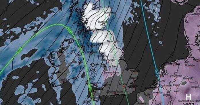

Britain is gearing up for an imminent snowfall as the Met Office issues an amber warning, raising concerns about potential travel disruptions and power outages. According to fresh maps from WXCHARTS utilizing MetDesk data, snow is expected to start around 6 am today, covering a vast area from Cape Wrath in northern Scotland to the Peak District in Derbyshire.
By 9 am, parts of Aberdeenshire and the Highlands could see up to 18 inches of snow, the heaviest snowfall in the UK. English regions, particularly the North West, may experience up to 6 inches of snow. The Met Office’s Sunday forecast indicates wet and windy conditions with snow in the north and a risk of ice due to freezing rain. Coastal areas will experience strong winds and gales, while the west will remain mild.
Additionally, the Met Office has issued yellow and amber weather warnings for today, cautioning about wind, rain, snow, and ice. A rare amber alert for snow is in effect for Scotland from 3 am to 3 pm, predicting travel delays on roads, potential rail and air travel disruptions, and the likelihood of rural communities being cut off. Power cuts and disruptions to services like mobile phone coverage are also anticipated.