

Millions of residents in urban areas like London and Birmingham are likely to witness snowfall in the upcoming week as weather forecasts indicate a significant amount of snow heading towards the UK.
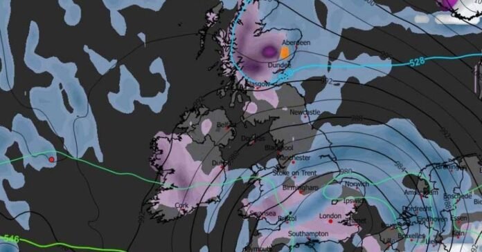
Cutting-edge weather modeling maps predict a major storm approaching Britain next Sunday, bringing heavy snowfall and intense rainfall. The GFS weather model indicates a heavy snowfall in Wales during the early hours, while the Midlands and southern England are expected to experience substantial rainfall.
By 3 am, the weather front is projected to swiftly move eastward, resulting in snowfall in London and Essex. Meanwhile, heavy rain showers are anticipated in East Anglia and the southeast around the same time.
Snow coverage maps illustrate the extensive reach of this wintry weather event, with snow covering most of southern England and a significant portion of the Midlands, including parts of Birmingham. Wales is also forecasted to be blanketed in snow, along with central and northern regions of Scotland, including Glasgow and Edinburgh.
The BBC Weather forecast for the following week hints at the possibility of more snow, albeit not widespread. However, the forecast suggests that any snow is likely to thaw quickly due to temperatures remaining near or above the January average.
The Met Office forecast for the remainder of January does not currently include snow but mentions the likelihood of heavy rain showers across the UK. From January 15 to 24, changeable and occasionally unsettled conditions are expected, with low-pressure systems bringing showers or longer spells of rain, particularly in western areas.
Intermittent dry spells are expected between weather systems, with temperatures forecasted to be around or slightly above average for this time of year.