
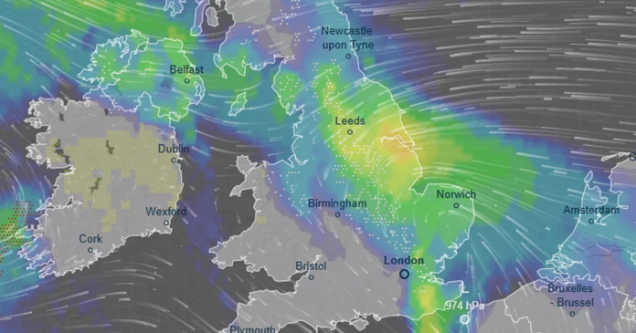

Weather maps have been released detailing the anticipated widespread snowfall across the UK. The upcoming weather is expected to bring several inches of snow, with South Yorkshire and Lincolnshire likely to experience heavy snowfall as two weather systems clash. The Met Office has confirmed the snow forecast, with detailed information now available through the newly released maps showing areas of low pressure indicated by yellow and green hues.
According to Metdesk forecasters, snowfall rates could reach up to 6cm per hour on Tuesday evening, with South Yorkshire, Lincolnshire, West Yorkshire, and County Durham expected to receive the most significant snow accumulations as a band of low pressure moves northeastward.
The weather maps indicate that snow is predicted to fall as far south as Kent on Tuesday. Eastern regions are expected to bear the brunt of the inclement weather, with parts of north Wales also likely to see some snow showers. Conversely, most of Southwest England will have a dry but cold day as temperatures drop.
The Met Office has outlined the weather outlook from Tuesday, January 27, to Thursday, February 5, mentioning the likelihood of cold air from the northeast bringing wintry showers, especially in hilly areas. Despite recent mild temperatures in some regions, a bitter easterly wind is forecast to make it feel much colder, with temperatures possibly dropping to -8C in Scotland and -6C in northern England by Tuesday.
Meteorologist Nick Finnis from Netweather highlighted a weather battle unfolding in the UK between a high-pressure system from Siberia and incoming low-pressure systems from the west. This clash, influenced by a strong jet stream moving across the North Atlantic, could lead to cold air spreading westward, potentially resulting in snow across various parts of the UK.
Overall, the weather patterns indicate a shift towards colder conditions in the upcoming days, with the possibility of snow affecting different regions across the UK due to the complex interplay of weather systems.