
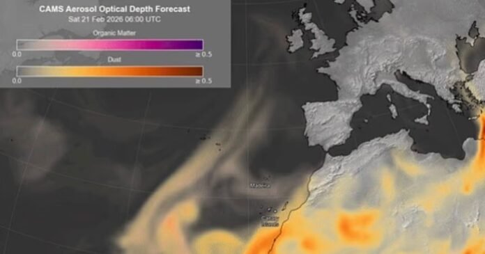

Britain is expected to experience ‘blood rain’ due to a surge of sand from the Sahara desert. This unique meteorological event is forecasted to occur within the next 24 hours as strong winds transport dust from North Africa across Western Europe towards the British Isles. The dust is carried by low-pressure systems into the atmosphere, traveling thousands of miles before precipitating as rain.
Despite its dramatic name, ‘blood rain’ will likely manifest as dust residues on car windscreens and a potential orange tint in the sky. However, areas with high dust concentrations may also face compromised air quality. Mark Parrington, a Senior Scientist at the Copernicus Atmosphere Monitoring Service, mentioned that the phenomenon is expected to pass over southern England and the Channel at higher altitudes, potentially resulting in wet deposition at ground level if mixed with rain.
According to the Met Office, the wind’s force over deserts can lift dust and sand into the sky, which can be carried long distances by upper atmospheric winds, eventually reaching the UK. As raindrops fall through the dust-laden atmosphere, they accumulate particles, depositing them when evaporating, leaving a layer of dust.
The weather outlook for the week includes a mix of sunshine, showers, and milder conditions, with a spring-like feel in many regions. Temperatures are anticipated to rise, with southerly winds bringing mild conditions, particularly in southern areas. Heavy rain is forecasted for the far northwest, while exceptionally mild temperatures, possibly exceeding 17C in some southern areas on Thursday, are expected, resembling early May averages.