

Forecasters are anticipating a drop in temperatures over the upcoming weekend following the conclusion of the UK’s third heatwave of 2026. However, weather projections indicate that it won’t be long before temperatures rise again, potentially reaching the mid to high-30s.
The Met Office is predicting that peak temperatures will hover around 30C to 31C until Saturday, before experiencing a significant decline on Sunday with highs of 25C in southern regions and 22C in northern areas.
According to the Met Office, the weather will remain dry and settled leading into the weekend, although cloud cover is expected to increase. Despite temperatures returning to more typical levels, the agency anticipates a pleasant atmosphere in the sunshine.
The latest data from the GFS weather model suggests a potential resurgence in temperatures, possibly reaching as high as 36C on the following weekend. On July 25, temperatures could peak at 34C and 35C in various regions, while July 26 might see highs of 36C in the east of England.
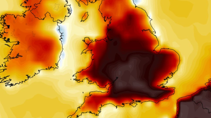
Temperature anomaly maps indicate that the UK is likely to experience above-average temperatures during that weekend, with several counties in England potentially reaching 35C or higher.
Looking ahead, the Met Office foresees temperatures remaining above average towards the end of July, with an increased likelihood of thunderstorms. The agency’s forecast for July 19 to July 28 highlights a potential shift towards more rain, showers, or thunderstorms compared to earlier in the month, while temperatures are expected to stay elevated.