
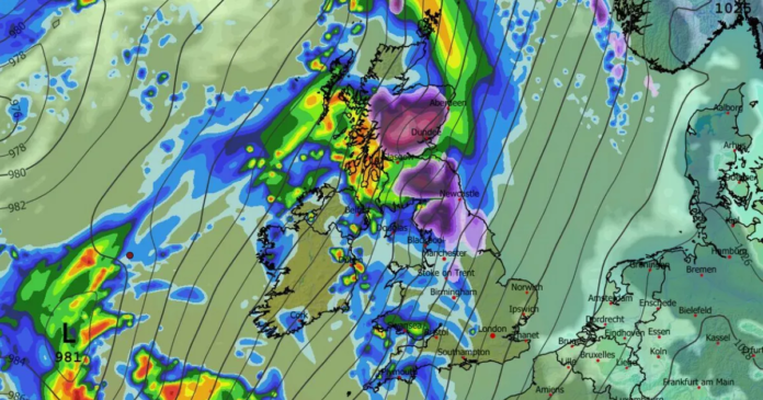

The Met Office has advised residents in 51 regions to prepare by stocking up on three essential items ahead of an incoming snowfall. A yellow alert for ice and snow is effective from 2 am to 3 pm on Sunday, encompassing a large portion of Scotland and northern England. Snow accumulation of up to 10cm is expected in lower areas, while regions above 200m could experience a snow blanket of 20cm, along with windy conditions leading to drifting and widespread icy surfaces.
Potential travel disruptions, stranded vehicles, injuries from slipping on ice, and power outages affecting mobile communication have been highlighted as risks. To ensure safety, the Met Office recommends having torches, batteries, and a mobile phone power pack ready, in addition to other necessary supplies.
The warning matches the previous day’s snow and ice advisory but extends to more areas in the North West while reducing coverage in the East Midlands and Yorkshire. An amber warning for heavy snowfall has been issued for the following day in Central, Tayside & Fife, Grampian, and Highlands & Eilean Siar.
Simultaneously, a yellow ice warning continues until midday today across various regions, cautioning about frozen snow refreezing, freezing fog, and wintry showers that can lead to icy conditions and increase the risk of accidents. Another yellow snow and ice alert covering Northern Ireland from yesterday evening until this morning predicts icy patches and hill snow.
The warnings come after severe weather conditions during Storm Goretti, which caused power outages, travel disruptions, and school closures. The storm brought powerful gusts reaching up to 99mph in South West England and resulted in numerous flight delays and cancellations at airports in London and Birmingham.