
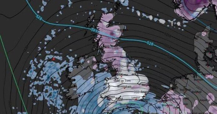

Britons are preparing for an upcoming snowfall spanning a massive 656-mile stretch from London to just south of John O’Groats, expected to hit the UK by the end of January. Weather predictions indicate a significant snow band moving east over Bulgaria and Hungary on January 30, reaching the UK at 6 am the following day. Most of the UK is likely to experience wintry weather on Saturday, January 31, with Cornwall and Northern Ireland potentially being the only regions without snow.
Temperatures are forecasted to drop to as low as -5°C in some parts of the country, while Europe braces for even colder conditions. Maps illustrate a vast white cover from Essex to Pembrokeshire, encompassing areas north of London, Wales, most of England, and a majority of Scotland. By midday, snow is expected to start accumulating in northern England and Scotland, while the likelihood decreases in the south.
Southern England is set to face freezing temperatures, with lows of -3°C in the Cotswolds by Saturday morning, indicating possible icy road conditions. The Midlands may stay above freezing, while the north could see temperatures drop to -2°C. Rural areas of Scotland could experience temperatures as low as -5°C, with major cities like Aberdeen, Edinburgh, and Glasgow hovering around freezing. Wales and Northern Ireland are expected to have mixed conditions, with Wales fluctuating between freezing and -2°C and Northern Ireland likely to have rain instead of snow.
The Met Office acknowledges the difficulty of predicting snowfall but has highlighted the potential for cold weather and snow in the extended forecast for the next four weeks. The upcoming period is anticipated to involve a clash between Atlantic weather systems from the west and high pressure with colder conditions from the east. This could lead to increased chances of cold weather and snow in the coming weeks, especially in early February.
Looking ahead to February, the Met Office warns of the possibility of cold conditions affecting the UK and the potential for wintry hazards. Later in February, there may be a shift towards more unsettled conditions and a rise in temperatures closer to average levels.