
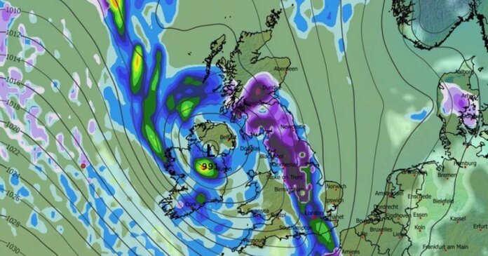

A blizzard is expected to bring up to 85cm of snow as the Met Office forecasts a higher possibility of colder weather and wintry conditions. Britons are bracing for more wintry weather in the upcoming weeks following Storm Goretti’s icy start to January. Weather maps indicate low-pressure systems moving in from the Atlantic, meeting cold Arctic air, resulting in snowfall.
Early February is set to see a low-pressure system lingering over Ireland, likely bringing heavy snow across the UK in a wave-like pattern. The most substantial snowfall is anticipated in Scotland, possibly reaching 85cm deep, with scattered flurries expected along the south coast.
By 6 pm on February 1, the weather map shows dark purple snow clouds over northern England and Scotland, shifting slightly east by 9 pm, lingering over central Scotland. Temperatures are forecasted to drop significantly, with central Scotland potentially reaching -11°C and south Wales expected to hit -10°C by midday on February 2.
The Met Office warns of a heightened probability of decreasing temperatures following an initial drop in the North East. From January 23 to February 1, the UK is predicted to experience a clash between Atlantic weather systems from the west and high pressure bringing colder, drier conditions from the east. Initially, milder Atlantic air will prevail, with occasional rain showers.
Looking ahead to February 2-16, the Met Office anticipates continued cold conditions and wintry weather risks. The weather patterns are expected to evolve slowly near the UK, with low pressure to the west or southwest and high pressure to the northeast, increasing the likelihood of cold weather and wintry hazards. Later in February, conditions may become more unsettled, with temperatures edging closer to average levels.