
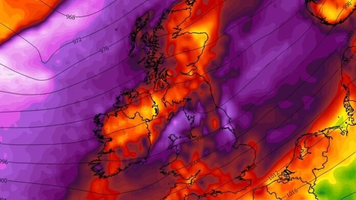

The UK is facing severe weather conditions this week, with weather maps displaying purple, red, and yellow hues indicating 70mph gale-force winds hitting the country. The Met Office has issued warnings of strong winds, heavy rain, and possible snow lasting over 15 hours today, affecting transportation services and potentially causing power outages across all four nations.
Detailed weather maps highlight the regions expected to experience the most intense winds as the storm moves southeastward. The Met Office’s warning, effective until 8pm today, anticipates wind speeds escalating up to 70 mph in certain coastal and elevated areas after starting at 5am this morning.
The forecast indicates that the strong winds are associated with a frontal system advancing southeastward across the UK, with gusts reaching 60 to 70 mph in some locations. Wind speeds are forecasted to ease as the day progresses, with WXCharts illustrating the progression of the system from Northern Ireland to Wales, Scotland, and England.
The most severe winds are expected in northern England, northern Wales, and inland areas in the east, such as Newcastle, Snowdonia, and Cambridge, with wind speeds potentially reaching 111kph (68mph). Weather warnings have been issued for several regions across the country, indicating sustained intense winds until midnight in some areas.
Please note that your preferences are browser specific. Use of our website and any of our services represents your acceptance of the use of cookies and consent to the practices described in our Privacy Notice and Terms and Conditions.