
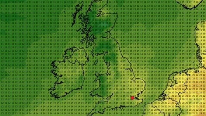

Temperatures are expected to drop significantly next week, potentially reaching as low as 5 degrees Celsius following a period of exceptionally hot weather, as indicated by the latest weather predictions. The end of May saw a remarkable surge in temperatures across the UK, with several areas experiencing full-fledged heatwave conditions. The national weather agency reported that 23 weather stations broke the previous UK May temperature record of 32.8 degrees Celsius, reaching highs of 35.1 degrees Celsius at Kew Gardens in Greater London on May 26.
However, the recent Mediterranean-style warmth is predicted to diminish for now. The Met Office announced that the heatwave will gradually weaken in the upcoming days, transitioning to cooler and more unsettled conditions by the weekend. Chief Forecaster Chris Bulmer mentioned that the hot spell is dissipating, with fresher conditions moving in and the likelihood of showers and thunderstorms as temperatures return to normal for this time of year.
Forecasts from WXCharts suggest that maximum temperatures next week in the UK will hover around the mid-teens Celsius, with a potential drop to as low as 5 degrees Celsius in Scotland by Sunday, June 7. While temperatures are anticipated to range from 7 to 11 degrees Celsius in Scotland and England, and between 7 to 10 degrees Celsius in Wales, a climb to the mid-teens is expected later on. Areas like the East Midlands, East of England, South East, and Greater London may see temperatures ranging from 11 to 20 degrees Celsius.
Looking ahead, the Met Office’s long-range forecast for early June foresees Atlantic weather systems moving in from the west, bringing occasional rain showers. Drier conditions are more likely in the south and east, with temperatures remaining near-normal, particularly in eastern regions. Breezy conditions, especially along exposed coasts, are also expected during this period.