
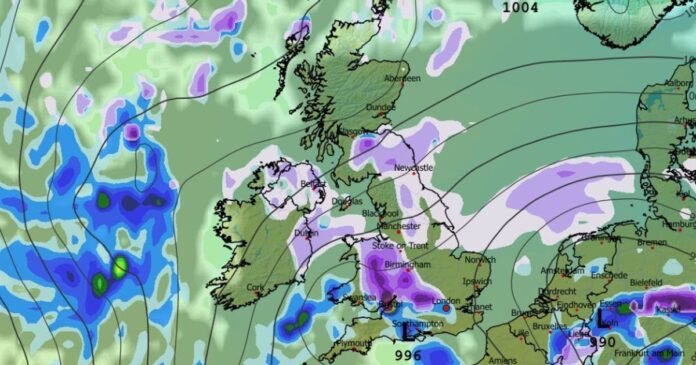

Advanced weather modeling indicates that residents in the UK might experience four consecutive days of snow soon, with snowfall expected to impact various major cities. The snow is predicted to begin in Scotland on February 13 and gradually move southwards to Wales and significant parts of England, as per the GFS weather model.
By 6 am on February 14, the modeling shows intense snowfall concentrated around Glasgow and the north-east of England, with Newcastle, Yorkshire, and Edinburgh also likely to be affected. The snow is forecasted to continue in Scotland and the north-east through February 15, before spreading southward to the rest of England and Wales on February 16.
At 3 am on February 16, snowfall is projected in Manchester, with possible flurries in Northern Ireland around the same time. By midday, Wales, the Midlands, and parts of southern-central England could all witness snow showers, including major cities such as Birmingham, Cardiff, and potentially London.
Snow coverage maps suggest that by 9 pm on February 16, areas including Scotland, Northern Ireland, Wales, northern England, parts of the Midlands, and some southern regions could have accumulated snow on the ground. The highest snow accumulations are expected in the Scottish Highlands, with up to 72cm (28 inches) and the North Pennines potentially seeing 21cm (eight inches).
The Met Office also hints at the possibility of snow later in the month, with ‘wintry hazards’ likely even in southern regions. The forecast for February 7 to 16 mentions the potential for rain and snow in northern England and Scotland due to frontal systems from the Atlantic encountering colder air. The forecast for February 17 to March 3 suggests wet and windy weather, with some hill snow possible in northern parts of the UK.
The outlook for temperatures during this period is expected to be close to average for most areas, with a chance of slightly lower temperatures in the northeast initially.